A highlight to some of the work of lacollineenchantee980...
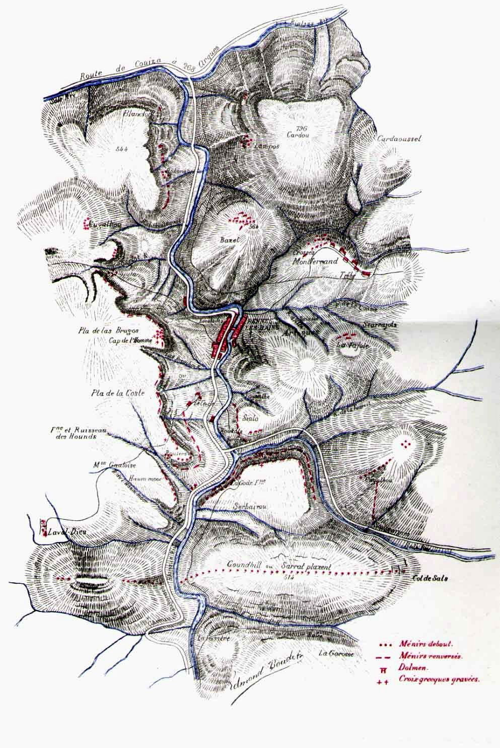
On page 243 Boudet tells us about the east side of the cromleck.
First of all he tries, as usual, to demonstrate the origin, the etymology of the place la Fajole, from the English, Fadje for "fa" and the English "hole" - trou
This works well, with the Celtic H(ache) nearby of course.Further on Boudet puts us on the trail of a piece of land located in Montferrand near the stream he calls "Coural", but this stream does not exist on the IGN map - it is called "Coudal" ... is this a deliberate error by Boudet like the [other] stream "Coume" [he names wrongly] which is actually called "Dous" on the IGN map?
Boudet is again mistaken about a stream, the Coudal which he calls "Coural". Strange, isn't it?
The rest is even more interesting because he tells us about a piece of land located between Montferrand and the Coudal stream where the latter forms an arc.
This piece of land is called "Crosses", more precisely "lés Crossés"
Inevitably Boudet traces the origin of "Crossés" back to the Celtic/English "Cross", that is to say "Cross" in French.
However, the Occitan "lés Crossés" means "Les tombes" Crossés being the plural of "Cros" which means "tombs" and not "cross".
I said in a previous video that the toponym "clot das hourcés" was the only toponym linked to the notion of tomb, this is not correct, because "lés Crossés" is also linked to the notion of tomb.
The Occitan terms, Cros and Clot, are synonyms for tomb.
These two toponyms clearly indicate that tombs exist or have existed in this part of Rennes-les-Bains. This is apparently what Boudet wants us to understand.
Here is a map [added by Rhedesium] to look for these places where the tombs might be.
